Ozark Trail: Karkaghne Section | Day 9
Hiking the Karkaghne Section to Sutton Bluff Campground.
Disclaimer: This post contains affiliate links, which means I may receive a small commission if you purchase something through them at no extra cost to you! -michael

My Ozark Trail Backpacking Gear List
Day 9 of my Ozark Trail Thru Hike and I'm hiking 13.4 miles on the Karkaghne Section from Grasshopper Hollow to just past Sutton Bluff Recreation Area. The highlights of this section of the Ozark Trail are definitely the Bee Fork creek crossing and Sutton Bluff Campgrounds.
Karkaghne Section (Mile 22-9)
Day 9 - October 22, 2024
Grasshopper Hollow to Sutton Bluff
Rate: Moderate | Traffic: Low
Distance: 13.4mi | Elevation Gain: 1,906ft
Join AllTrails+ to get the most out of your hiking.
Sutton Bluff Recreation Area & Campground
Amenities: Electric Hookups, Toilets, Shower
Camping: Small Fee
More Information

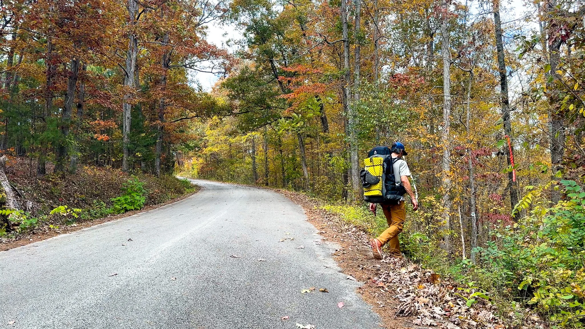
Leaving my campsite at Grasshopper Hollow (Mile 22 of the Karkaghne Section).
The day started with me hiking out of Grasshopper Hollow, fully loaded with water from the fen. Camping at Grasshopper Hollow was nice. It was a good, soft, level spot.
At 10am I stopped for my normal breakfast, Mountain House Breakfast Skillet. The only thing of note along this stretch of the Karkaghne Section so far was the relative lack of trail blazes. To be honest, that’s probably because they weren’t very necessary as the trail was very easy to follow. As I got further north on my thru-hike I would notice this; the trail becoming easier to follow equals less trail blazes, which makes sense. I do commend the Ozark Trail Association for the ample amount of trail blazes on some of the more sparse sections like the Eleven Point. There was always a trail blaze around when you needed it.
“Pro Tip: Sometimes the closest trail blaze is actually behind you. If you don’t see a trail blaze ahead, turn around.”


Stream at OTA Map Mile 17
Six miles into the hike I came upon a surprisingly large stream at Karkaghne Mile 17. I was a bit shocked that there was so much water at this stream since as the OTA map labels it as an “intermittent stream with seasonal water.” The supposedly more reliable sources (Karkaghne Mile 17 & Grasshopper Hollow) were dry. I figured this would be as well. I was wrong.


Bee Fork Creek
Three miles from the Stream and I arrived at Bee Fork Creek, a beautiful, open creek crossing featuring large gravel bars on either side. Bee Fork feeds into the Black River just a few miles to the east. The OTA Map lists Bee Fork as typically being 1-2 feet deep, which would like shrink those gravel bars, and that it’s prone to flash flooding. For me, in October, it was a very simple rock hop across the stream. This is a great spot to take a break!


Sutton Bluff Recreation Area
From Bee Fork it’s a short 4-mile hike, mostly downhill, to the Sutton Bluff Recreation Area Campgrounds which resides along the West Fork of the Black River. Along the way the trail runs alongside some smaller bluffs foreshadowing the main attraction at the Sutton Bluff gravel beach and swimming area. The slow moving Black River meandering below the bluff makes for a very peaceful and serene experience. It’s evident why the Sutton Bluff Recreation Area is a popular outdoor swimming location during the hot and humid Missouri Summers.

The gravel beach at Sutton Bluff Recreation Area.
After spending some time relaxing on the gravel beach by the Black River, I crossed the bridge into the Sutton Bluff Campgrounds. This is a full service campground with all the amenities: electric hookups, drinking water, toilets, picnic tables, and even showers (there is a fee to camp here). This would have made an ideal campground to recharge my Charmast Portable Power Bank and spend the night. The only downside is that Sutton Bluff is seven miles from Brushy Creek Lodge & Resort where I planned to meet Abby the next day for my second resupply. It didn’t really make sense to spend the money, albeit for the small fee that it is, when I would have all of the same amenities the next. Plus Abby! And maybe a dog??


Trail Review
The hike from Grasshopper Hollow to Sutton Bluff Recreation Area on the Karkaghne Section of the Ozark Trail was a pretty solid stretch of trail. The highlights were definitely Bee Fork and the Sutton Bluff gravel beach. As I get further north on my thru-hike the sections seem to be getting a little more scenic. Tomorrow, I meet Abby at Brushy Creek Lodge for my second resupply and learn what happened with the abandoned puppy we found on the Ozark Trail at Peck Ranch.

Missouri’s Ozark Trail
The Ozark Trail contains over 430 miles of trail divided into 14 mostly connected sections throughout southeast Missouri. The established thru-hike covers eight of the connected sections and runs from Onondaga Cave State Park in Leasburg, roughly 84 miles southwest of St. Louis, to the Eleven Point Terminus near Thomasville, 23 miles north of the Arkansas border. Throw in the off-shoot Taum Sauk Section and you have nearly 300 miles of thru-hikeable trail.