Ozark Trail: Karkaghne Section | Day 8
Starting the Karkaghne Section on Day 8 of my Ozark Trail Thru Hike.
Disclaimer: This post contains affiliate links, which means I may receive a small commission if you purchase something through them at no extra cost to you! -michael

My Ozark Trail Backpacking Gear List
My first real water scare on my Ozark Trail Thru Hike. It’s still Day 8 and set out on the Karkaghne Section from Hwy 72 to Grasshopper Hollow. Water was scarce along the way and it wasn’t where it was supposed to be at Grasshopper Hollow. I had to walk deep into the fen to find it.
Karkaghne Section (Mile 28-22)
Day 8 - Part 2 - October 21, 2024
Highway 72 Trailhead to Grasshopper Hollow
Rate: Moderate | Traffic: Low
Distance: 6.5mi | Elevation Gain: 403ft
Join AllTrails+ to get the most out of your hiking.

Setting out on the Karkaghne Section of the Ozark Trail from the Highway 72 Trailhead.
Karkaghne Section
The Karkaghne Section of the Ozark Trail is a 29 mile stretch running from Highway J in the north to Highway 72 in the south. A moderately difficult section of the OT, the Karkaghne is mainly a side-slope trail running along the rolling hills of the Mark Twain National Forest. The major creek-crossing of this section is Bee Fork at OTA Mile 14. The trail also passes by Sutton Bluff Campground and Brushy Creek Lodge & Resort. The major environmental feature of the Karkaghne Section is Grasshopper Hollow, which is the largest fen complex in non-glaciated North America.


Where is the water?
The Ozark Trail Association maps listed several water sources between Miles 28-22 on the Karkaghne Section. Every established water source listed on the maps prior had come through for me so I wasn’t too concerned. Particularly since I had made it through the Between the Rivers Section, the most sparse section in terms of water sources. But my confidence was a bit premature.
I departed from MO-72 and hiked 1.5-miles to the Stream marked on the OTA Map, Mile 27, only to find it dry. This was a surprise. It was also where I was planning to fill up. I had about a litre of water on me. The next reliable water source was the Small Pool in Grasshopper Hollow, five miles down the trail.

The feeling you get when your second water source might be dry.
The 5-mile stretch between OTA Map Mile 27 and Grasshopper Hollow (OTA Map Mile 22) was mostly flat woods-walking. The trail was easy enough to follow even if a bit brushy with undergrowth. I got through it pretty quickly arriving where I assumed the small pool would be where the trail crosses County Road 860.
What is a Fen?
Fens are a type of wetland. Wetlands are ecosystems where the water table is at or near the ground surface for most of the growing season on most years, and as a consequence, the substrate is poorly aerated, and inundation or saturation last long enough that the dominant plants are those that can exist in wet and reducing conditions. US Forest Service [LINK]
I came across several fens during my Ozark Trail Thru Hike, but I’ll admit, I did not know what a fen was while I was hiking. The trail crossing at CR-860 was characterized by several large downed trees in a hollow near a dry creek bed. In wet conditions I could see how there would likely be pools of water at this crossing. For me there were none. My first real water scare kicked in.
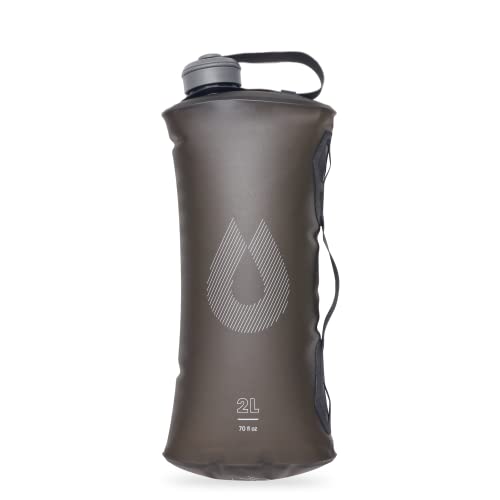
My water treatment system on the Ozark Trail.


Thankfully, the OTA Maps have a note stating…
“Reliable water in Grasshopper Hollow - you may find it where the trail crosses the bottoms, or you may have to walk down the gravel road to the fen area.”
So I headed down the gravel road to the Grasshopper Hollow Fen Area, which is marked by several large wooden signs.


Grasshopper Hollow Fen Area
The gravel road ends in a grassy cul-de-sac. Just past the cul-de-sac you’ll notice another wooden sign and a green metal gate. Barbed wire fencing extends out around it to protect the delicate ecosystem from vehicle traffic. There also happened to be another downed tree right in front of the gate, which made for a fun little obstacle to crawl through with a full pack.
Once I got passed the gate I didn’t know where to go. There was a dry creek-bed though, so I figured I’d follow that downhill until I found water, which I did, about a half-a-mile into the fen. It was a small pool sitting in what looked to be another small creek surrounded by waist high grasses. I was very grateful it was there as the next reliable water source was 5-miles further down the trail. I filled up and camel’d up, aka chugged my fill.


Camping in the Grasshopper Hollow Cul-de-Sac
After filling and filtering water I made my way out of the fen, through the gate and downed tree, and back into the cul-de-sac. It was approaching 5p at this time and I figured it would be easier to camp in the cul-de-sac for the night and start my hike toward Sutton Bluff the next day.


Missouri’s Ozark Trail
The Ozark Trail contains over 430 miles of trail divided into 14 mostly connected sections throughout southeast Missouri. The established thru-hike covers eight of the connected sections and runs from Onondaga Cave State Park in Leasburg, roughly 84 miles southwest of St. Louis, to the Eleven Point Terminus near Thomasville, 23 miles north of the Arkansas border. Throw in the off-shoot Taum Sauk Section and you have nearly 300 miles of thru-hikeable trail.