Ozark Trail: Blair Creek Section | Day 7
Ozark Trail Thru-Hike Day 7: Starting the Blair Creek Section
Disclaimer: This post contains affiliate links, which means I may receive a small commission if you purchase something through them at no extra cost to you! -michael

My Ozark Trail Backpacking Gear List
It’s Day 7 of my Ozark Trail Thru Hike and I embark on the Blair Creek Section which starts with a climb to an amazing bluff view of the Current River just above Powder Mill Campground.
Blair Creek Section (Mile 26.5-11)
Day 7 - October 20, 2024
Powder Mill Campground to Laxton Hollow
Rate: Difficult | Traffic: Low
Distance: 16.9mi | Elevation Gain: 2,000ft
Join AllTrails+ to get the most out of your hiking.
Powder Mill Campground
Amenities: Vaulted Toilets (No Electric)
Open: Year-Round
Camping Fees: Summer (Apr 15 - Oct 15), $10 | Winter (Oct 16 - Apr 14), $0.

Bluff view of Owls Bend along the Curren River just north of Powder Mill Campground.
Blair Creek Section
The Blair Creek Section of the Ozark Trail runs 27 miles from the Highway P / 72 trailhead in the north to Powder Mill Campground at the southern terminus of the section. Because I’m hiking south to north I head out from Powder Mill Campground, immediately crossing MO-106 and ascending a hill to a beautiful bluff view overlooking Owls Bend on the Current River. There is a campsite at the top of the bluff where I met a couple who spent the night there. From the bluff I was greeted by soaring turkey vultures and even a bald eagle.


Bloom Creek
I descended off the bluff and continued on for roughly two miles until I reached Bloom Creek where I stopped for breakfast (Mountain House Breakfast SKillet). Bloom Creek was flowing and the trail crossed at a lovely bend in the creek. This was the first of several creek crossings this day as water seemed to be plentiful on the Blair Creek Section even during the dry October Missouri was experiencing.


After breakfast I was faced with three successive hill climbs followed by a gradual ascent. Based on the elevation topo of my downloaded AllTrails map it went small climb, big climb, small climb, but didn’t look too strenuous.
My typical breakfast when thru-hiking the Ozark Trail.


Who Maintains the Ozark Trail?
Just before reaching Little Blair Creek (OTA Map Mile 21) I ran into my friend Devin Barnett who works for the Ozark Trail Association with several Americorp volunteers doing some trail maintenance. It was amazing running into Devin on the trail because he was such a helpful resource when I was planning this thru-hike. We were able to catch up on the trail and chat about the trail to come. True to form of being two men hanging out, we did not take a photo together, so you’ll just have to trust me that we ran into each other in the middle of the woods.
Blair Creek Crossing #1
A couple more miles of woods-walking and the trail merges with County Road 242 near Holmes Hollow. Following the gravel road for a mile is a nice change of terrain after walking through the woods. You also pass by Blair Creek Cemetery before reaching Blair Creek itself.


The first Blair Creek Crossing for me was at OTA Map Mile 18.5. According to the OTA map this crossing is typically 1-2 feet deep. I was lucky because for me it was only a couple inches deep. I didn’t even have to take my hiking shoes off as I hopped along a natural bridge of rocks across the creek.
The next three miles of the trail essentially follows Blair Creek either along the hillside or in the hollows. The trail on the hills is not much wider than a “goat trail” and I needed to step cautiously so as to not roll an ankle. The hollows, like all the hollows before, continued to be brushy.
“Hiking in the hollows was never my ideal piece of trail to hike. The undergrowth is thick and there isn’t too much to see.”
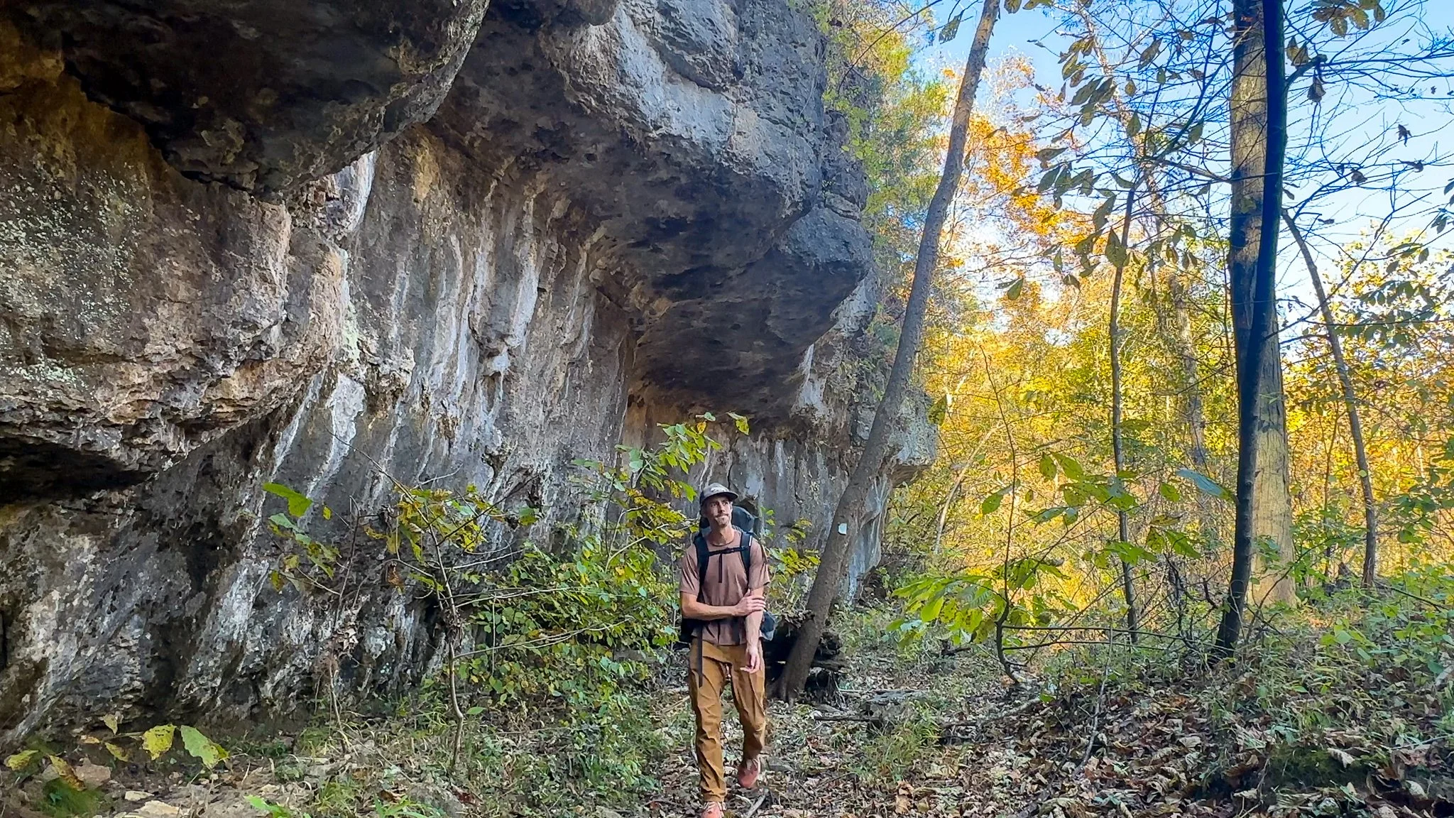
A mile passed Jim’s Creek and the trail traverses beneath a short overhung bluff. The rock climber in me was definitely eyeing the rock for potential routes, short as they might be. Then I came to an oddity.


Stone Cellar by Blair Creek
Right beside the trail is an old stone cellar dug into the hill. It’s big enough that you could sleep in it for a night, and it looked like backpackers before me had done just that. But if you don’t want to entomb yourself - and I don’t blame you - there is a primitive campsite with a fire ring right by the cellar.
After inspecting the cellar it was time for my second Blair Creek Crossing. The OTA maps say the creek here is typically 12-18” deep, but again the water was lower for me, enough to have to take my hiking shoes off. I also took the opportunity to fill up water for the night and morning.


From the crossing it was two more miles to the Laxton Hollow Trail split which connects to the Brushy Creek Trail at the Himont Trailhead. My original plan was to stop here for the night, taking the Laxton Hollow Trail to Laxton Spring about a half mile down the trail. Having filled up on water at Blair Creek decided to I skipped this and push on for a short distance until I found a nice spot to set up camp trailside.

“At this point I was becoming more and more comfortable hiking until days end and setting up camp wherever I found a nice spot. As long as I had enough water for dinner and coffee in the morning.”
Missouri’s Ozark Trail
The Ozark Trail contains over 430 miles of trail divided into 14 mostly connected sections throughout southeast Missouri. The established thru-hike covers eight of the connected sections and runs from Onondaga Cave State Park in Leasburg, roughly 84 miles southwest of St. Louis, to the Eleven Point Terminus near Thomasville, 23 miles north of the Arkansas border. Throw in the off-shoot Taum Sauk Section and you have nearly 300 miles of thru-hikeable trail.